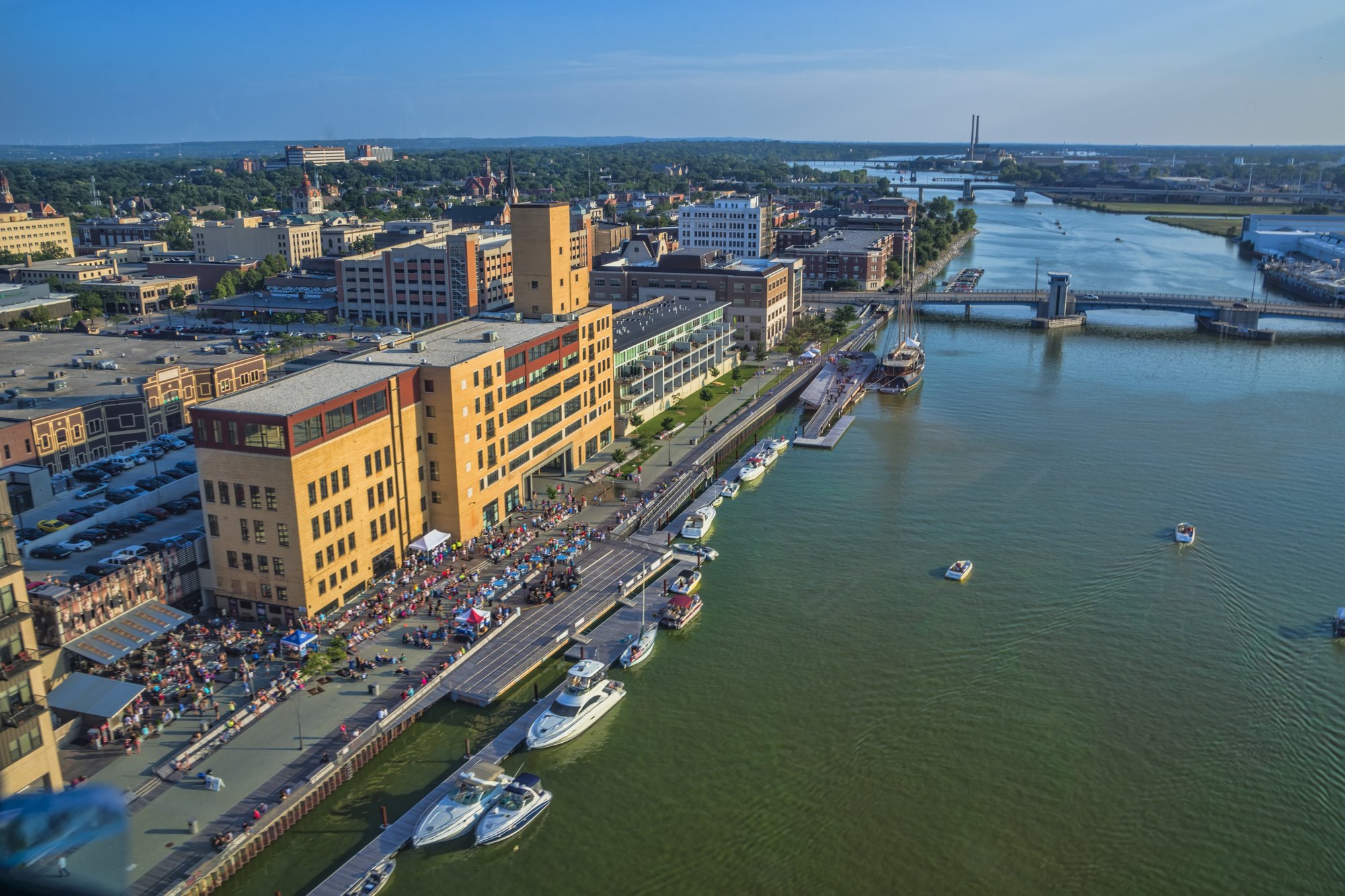
Downtown Green Bay and the Fox River

Outdoors

Hiking near Green Bay

National forests, parks, lakes and recreation areas with hiking trails near Green Bay, closest first.

22places to hike
39 mito the closest
April–Octoberbest months

Good to know: Carry more water than you think you need, check the managing agency’s page for trail closures and fire restrictions, and start early on hot days.

Closest picks

1

Sturgeon Bay & Lake Michigan Ship Canal

39 mi northeast · US Army Corps of Engineers

The project is located in the northeast portion of Wisconsin in the middle of The Door County peninsula. The ship canal is used as a shortcut for vessels using the ports of Green Bay and Menominee.


2

Boot Lake Campground

61 mi northwest · USDA Forest Service

Boot Lake Campground overlooks its namesake -- 263-acre Boot Lake. Bask in the sun on the beautiful beach and then take a relaxing dip in the lake, or enjoy the fishing. Boot Lake contains walleye, northern pike, bass, musky, and panfish.

3

Horicon National Wildlife Refuge

72 mi southwest · Fish and Wildlife Service

At more than 33,000 acres, Horicon Marsh is one of the largest freshwater marshes in the United States and is a critical rest stop for thousands of migrating ducks and Canada geese.

Map of all 22 places

Map of 22 places loads as you scroll.

30 to 75 miles (3)

39 mi northeast · US Army Corps of Engineers

Sturgeon Bay & Lake Michigan Ship Canal

The project is located in the northeast portion of Wisconsin in the middle of The Door County peninsula. The ship canal is used as a shortcut for vessels using the ports of Green Bay and Menominee.

  • Hiking

61 mi northwest · USDA Forest Service · Campground

Boot Lake Campground

Boot Lake Campground overlooks its namesake -- 263-acre Boot Lake. Bask in the sun on the beautiful beach and then take a relaxing dip in the lake, or enjoy the fishing. Boot Lake contains walleye, northern pike, bass, musky, and panfish.

  • Boating
  • Camping
  • Fishing
  • Hiking
  • Water sports
  • Wildlife viewing
  • Winter sports

72 mi southwest · Fish and Wildlife Service

Horicon National Wildlife Refuge

At more than 33,000 acres, Horicon Marsh is one of the largest freshwater marshes in the United States and is a critical rest stop for thousands of migrating ducks and Canada geese.

  • Archery
  • Biking
  • Birding
  • Cross Country Skiing
  • Fishing
  • Hiking
  • Hunting
  • Nature education

75 miles and farther (19)

76 mi northeast · Fish and Wildlife Service

Green Bay National Wildlife Refuge

On February 21, 1912, President William Howard Taft established Green Bay National Wildlife Refuge, our nation’s 28th refuge and only the second refuge in the Great Lakes region.

  • Archery
  • Birding
  • Boating
  • Fishing
  • Hiking
  • Hunting
  • Motor Boat
  • Non-Motorized Boating

83 mi east · USDA Forest Service · Campground

Lake Michigan At Manistee

Lake Michigan Campground is perched on the shores of Lake Michigan, 15 miles south of Manistee. The area creates an incredible setting with a scenic overlook of the lake and a sandy swimming beach.

  • Biking
  • Camping
  • Fishing
  • Hiking
  • Swimming

85 mi southwest · National Park Service

Ice Age National Scenic Trail

The Ice Age National Scenic Trail spans 1,200 miles, traverses some of Wisconsin's finest geologic and glacial features, and passes through the ancestral lands of 15 Tribes.

  • Camping
  • Fishing
  • Hiking
  • Wildlife viewing

91 mi north · USDA Forest Service · Campground

Morgan Lake Campground And Group Site

The Morgan Lake Campground and Group Site is a great place for families or a large gathering of people to camp in northern Wisconsin's Chequamegon-Nicolet National Forest.

  • Biking
  • Boating
  • Camping
  • Fishing
  • Hiking
  • Swimming

94 mi east · National Park Service · Campground

Platte River Campground

Platte River Campground is located in the southern district of Sleeping Bear Dunes National Lakeshore, on the lower peninsula of Michigan. This year-round facility is one of the most popular campgrounds in the park.

  • Amphitheater
  • Biking
  • Birding
  • Camping
  • Canoeing
  • Evening Programs
  • Fishing
  • Hiking

96 mi east · National Park Service · Campground

White Pine Backcountry Campground Permits

White Pine Backcountry Campground is a primitive camp located in the southern district of Sleeping Bear Dunes National Lakeshore, on the lower peninsula of Michigan.

  • Backpacking
  • Birding
  • Camping
  • Fishing
  • Hiking
  • Photography
  • Picnicking
  • Star Gazing

98 mi north · USDA Forest Service · Campground

Lost Lake Cabins

Lost Lake Cabins offers (11) cabins available for rent in the remote forested area situated on the shores of Lost Lake.

  • Accessible Swimming
  • Backpacking
  • Biking
  • Birding
  • Boating
  • Camping
  • Canoeing
  • Fishing

100 mi east · National Park Service · Campground

D.H. Day Group Campground

D.H. Day Group Campground is a tent-only facility located in the heart of Sleeping Bear Dunes National Lakeshore, about one mile (1.6 km) north of the Dune Climb, where visitors can walk over miles of sand dunes.

  • Biking
  • Camping
  • Hiking

100 mi east · National Park Service · Campground

South Manitou Group Campground

South Manitou Group Campground is a tent-only backcountry facility on South Manitou Island in Sleeping Bear Dunes National Lakeshore on Lake Michigan.

  • Camping
  • Hiking

102 mi east · National Park Service · Campground

D.H. Day Campground

D.H. Day Campground is located in the northern district of Sleeping Bear Dunes National Lakeshore, on the lower peninsula of Michigan.

  • Beach
  • Biking
  • Birding
  • Camping
  • Canoeing
  • Evening Programs
  • Fishing
  • Hiking

102 mi southwest · Fish and Wildlife Service

Leopold Wetland Management District

Leopold Wetland Management District is named after Aldo Leopold, who is widely acknowledged as the father of wildlife conservation in America.

  • Biking
  • Birding
  • Boating
  • Cross Country Skiing
  • Fishing
  • Hiking
  • Hunting
  • Nature education

102 mi east · National Park Service

Sleeping Bear Dunes National Lakeshore

Miles of sand beach, bluffs that tower 450’ above Lake Michigan, lush forests, clear inland lakes, unique flora and fauna make up the natural world of Sleeping Bear Dunes. High dunes afford spectacular views across the lake.

  • Biking
  • Camping
  • Fishing
  • Hiking
  • Hunting
  • Paddling
  • Swimming

106 mi east · USDA Forest Service · Campground

Sand Lake Campground

Sand Lake Campground is situated on the scenic shores of Sand Lake and provides a selection of sites shaded by a mixed hardwood forest. Just beyond the trees is a well-loved, sandy swimming beach.

  • Boating
  • Camping
  • Canoeing
  • Fishing
  • Hiking
  • Sailing
  • Swimming

108 mi east · USDA Forest Service · Campground

Upper Manistee River Backcountry Campsites

The Upper Manistee dispersed campsites are primitive campsites on the Manistee River Backwaters of Tippy Dam Pond, located along the banks of the Manistee River between Tippy Dam and Hodenpyl Dam.

  • Birding
  • Boating
  • Camping
  • Canoeing
  • Fishing
  • Hiking
  • Kayaking
  • Motor Boat

109 mi northwest · USDA Forest Service · Campground

Franklin Lake

Franklin Lake Campground is one of the most popular camping spots within the Chequamegon-Nicolet National Forest in Northern Wisconsin. Its unique structures built by the CCC land it on the National Register of Historic Places.

  • Boating
  • Camping
  • Canoeing
  • Fishing
  • Hiking
  • History
  • Kayaking
  • Ranger programs

111 mi northwest · USDA Forest Service · Campground

Anvil Lake Campground

If you are looking for a campground with a family atmosphere or a base camp to explore area trails, try Anvil Lake Campground off State Highway 70, just minutes east of Eagle River, within the Chequamegon-Nicolet National Forest.

  • Boating
  • Camping
  • Canoeing
  • Fishing
  • Hiking
  • Kayaking
  • Swimming
  • Wildlife viewing

111 mi west · Fish and Wildlife Service

Necedah National Wildlife Refuge

The prehistoric lands that make up Necedah National Wildlife Refuge sat at the bottom of Glacial Lake Wisconsin more than 18,000 years ago.

  • Archery
  • Birding
  • Boating
  • Cross Country Skiing
  • Fishing
  • Hiking
  • Hunting
  • Motor Boat

112 mi northwest · USDA Forest Service · Campground

Kentuck Lake Campground

Early settlers from Kentucky gave the name to Kentuck Lake. Kentuck Lake Campground is located on the east lake shore of Kentuck Lake in a stand of maple.

  • Biking
  • Boating
  • Camping
  • Canoeing
  • Fishing
  • Hiking
  • Kayaking
  • Wildlife viewing

131 mi east · USDA Forest Service

Huron-Manistee National Forests

Lying between the shores of Lake Michigan and Lake Huron in the northern half of the Lower Peninsula of Michigan, is the nearly one-million-acre Huron-Manistee National Forests.

  • Biking
  • Boating
  • Camping
  • Fishing
  • Hiking
  • Horse Camping
  • Horseback riding
  • Off-highway vehicles

Distances are straight-line miles from downtown Green Bay. Listings come from Recreation.gov’s federal recreation database; check each official page for hours, fees, fire restrictions and closures before you go.

Get outside around Green Bay

Around Green Bay

Asian Food Market- Green Bay, WI
Asian Food Market- Green Bay, WI - Flickr - MichaelSteeberMichael Steeber from USA · CC BY-SA 2.0
Neville Public Museum of Brown County, Green Bay
Green Bay July 2024 044 (Neville Public Museum of Brown County)Michael Barera · CC BY-SA 4.0
skyline and Fox River, Green Bay
Green Bay July 2024 045 (skyline and Fox River)Michael Barera · CC BY-SA 4.0

More outdoors near Green Bay

Questions

Where is the closest place for hiking near Green Bay?

Sturgeon Bay & Lake Michigan Ship Canal (US Army Corps of Engineers), about 39 miles northeast of Green Bay as the crow flies. Next are Boot Lake Campground (61 mi) and Horicon National Wildlife Refuge (72 mi).

When is the best time for hiking near Green Bay?

Based on Green Bay’s average highs, April–October. Conditions at higher elevations can be much cooler.

Who manages these places?

Federal agencies including USDA Forest Service, National Park Service, Fish and Wildlife Service. Each listing links to its official page for hours, fees, closures and current conditions.

Green Bay AI

Your Green Bay local guide
Hey there!

I'm Green Bay AI. Ask about neighborhood food, independent shops, local history or planning a visit.

AI recommendations may be inaccurate. Verify hours and prices. Questions are processed by Cloudflare. Privacy